Porto Rafti

Porto Rafti
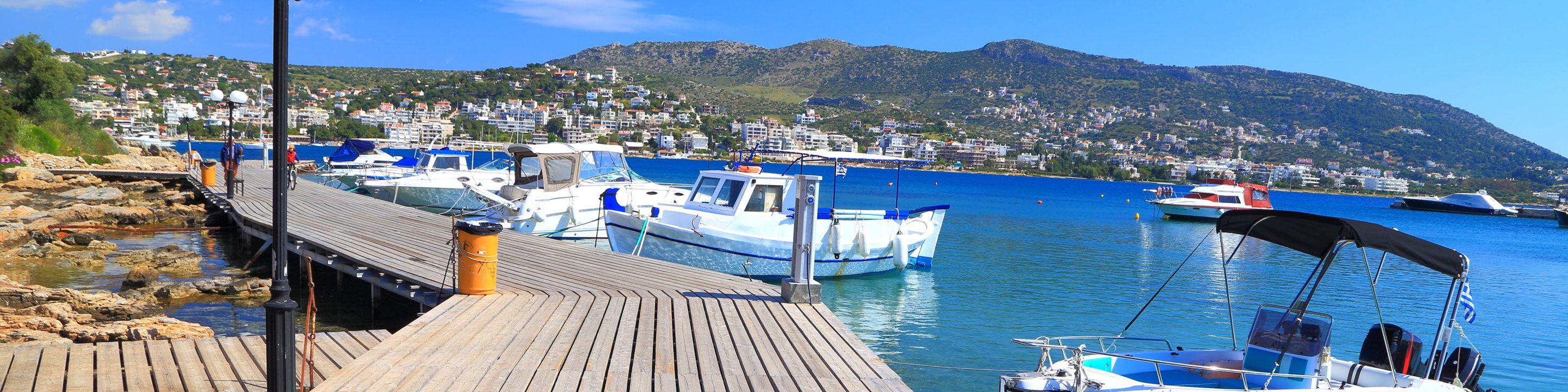
According to the census in 2011, there are 9,686 permanent residents and about 100,000 holidaymakers in the summer months. The bay of Porto Rafti includes 3 islets (Rafti, Rafopoula, Prasos) and coasts from Erotovpilia to Avlaki.
Porto Rafti is about 35–40 minutes from downtown Athens via the Attiki Odos (Attica Highway). It borders north with Athens Airport (about 15–20 minutes by car), south with Kouvaras in the wider area of Mount Merenda, westwards with Markopoulo Mesogaias and east of the South Evian Gulf. The large port of Porto Rafti connects Porto Rafti directly to the center of Markopoulo at a distance of about 10 km, via Vravrona road, which connects to the northernmost settlements of Vravrona and Chamolia and via Panorama Street, which starts from Avlakion Avenue - the location of the church of Agia Marina is connected with Kouvaras and Keratea. The traffic circle in the city center is the meeting point of the 3 major road junctions: Porto Rafti Avenue to Markopoulo, G. Gregou Street to Agios Spyridonas Beach and Avlakion Avenue to Avlaki.
A series of archaeological finds show the human presence in the area at least from the Early Bronze Age (2600-1800 B.C.). The area corresponds to the ancient municipalities of Prassi (south-east) and Sterea (north). During the Mycenaean Period (1580 - 1100 B.C.) there was an increase in the population with new settlements in the mountain of Perati, in Varaba near the chapel of Panagia, the islands Raftis and Rafopoula, Ligori, and Brassa.
In the 8th Century B.C., with the construction of the temple of Goddess Artemis in neighboring Vravrona, one of the most important sanctuaries in Greece, new settlements in the area were created. Other devotional sanctuaries existed in Meredanda and Hamolia. The residents are engaged in agriculture and trade with the Cycladic Islands at that time. In the early Byzantine Period, Porto Rafti was still inhabited as evidenced by ruins of a 3-aisled Early Christian basilica, an organized cemetery, a public building, a bath complex, remains of houses, sculptures, and coins. Since the 12th Century, after the collapse of Byzantium and the pirate raids, the area was deserted. The port was a major trading place until the collapse of the Roman Empire.
At the beginning of the 20th Century, Porto Rafti was a small settlement with inhabitants from Markopoulo whose main occupation was fishing, botany cultivation, and trade with the Aegean islands. The marina was also used by the Marco Cooperative to send wine and beer to the islands and northern Greece, as well as to export the same products to Marseilles. In 1962, in the Perateti area, a section of a Mycenaean cemetery with 21 impassable and 10 desolate graves was found. This port was the scene of the allied troops' evacuation after the German invasion in Greece at the end of April 1941.
Porto Rafti is today a well-known coastal resort of Eastern Attica, where the Municipal beach (Aulaki) is found. It is one of the areas, along with Markopoulo, Keratea, and Koropi that have experienced great residential development after the projects that took place in the wider region in 2004. The problem facing the area as well as the entire Mesogia is the creation of an integrated drainage system and water supply.
There is intense city life during the summer months with a host of cafes, bars, fish taverns, and grill houses but all are only along the major road junctions.


