Voula & Vouliagmeni

Voula & Vouliagmeni
There are three versions of how the city took its name. The first version is that it was named after a black-eyed fish thrived in the waters of the region, the second version is that in the 19th century Voula was a province with its own laws and rules, anyone who wanted to go from its way had to pay "tolls" and was marked with a bullet (voula in greek), while the third version is that borders of the city were bounded by stones that were marked with a big bullet.
Voula has an area of 8,79 km² and a population of 28,364 inhabitants. The area was inhabited since the Neolithic era, while in ancient times it numbered about 800 citizens who belonged to the Kekropida tribe. In 1920, the present settlement, which until 1929 was administratively built in the community of Koropi, was created. From 1929 until 1935 it was a settlement of the community of Vari and from then on it was a separate community. Its recognition in the Municipality took place in 1982, as it was maintained until 2010, while with the implementation of the Kallikratis project from 2010 and then it joined the Municipality of Vari - Voula - Vouliagmeni.
The Municipality is crossed by major roads, most notably Vouliagmenis Avenue, Kalymnos Avenue and Poseidonos Avenue - K. Karamanlis Avenue. Due to its seaside location and distance from Athens, the Municipality has been promoted to a suburb of high standards for its residents, as it has many kinds of installers of various activities for its citizens, such as Sports Clubs, Gymnastics Clubs, Municipal Stadiums, and A and B organized beach of Voula under the supervision of EOT (Greek Tourism Organisation).
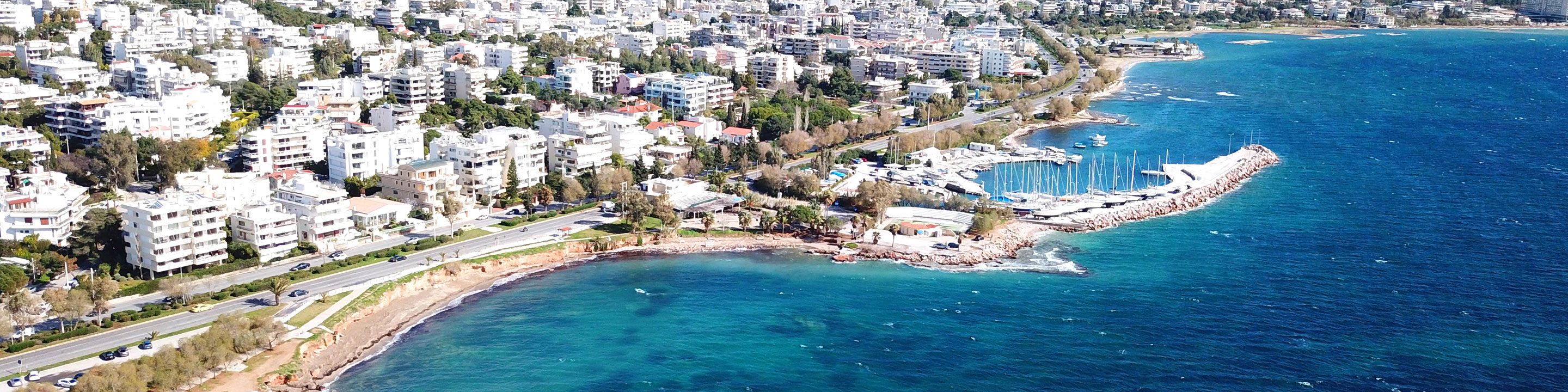
The Municipality of Vouliagmeni is located in the southern part of the prefecture of Attica, 25 km from Athens, built on the Saronic coast, named after the homonym lake created by the settlement of the land (that is what the name means: sank (vouliagmeni)) in the past.
Vouliagmeni has an area of 5.81 km² and a population of 6.442 inhabitants. Vouliagmeni was originally a holiday resort and until 1929 it was administrative in the Koropi community. From 1929 to 1935 it was a settlement of the Varis community, and later became a separate community. It was recognized as a municipality in 1985 as it remained until 2010, when with the Kallikratis project joined the Municipality of Vari - Voula - Vouliagmeni.
The Municipality is one of the most expensive areas, not only in the southern suburbs of Athens but also in Europe, because it has a long and undulating coastal zone, in which are formed the peninsulas of Kavouri and Lemos. The well-known Marina of Vouliagmeni, located on the coast of Mikro Kavouri, can accommodate up to 106 vessels up to 45 m long. Of course in the area there are many beaches of unique beauty organized and not, such as Vouliagmenis beach, Asteras Vouliagmenis, Limanakia, Lemos and Kavouri.