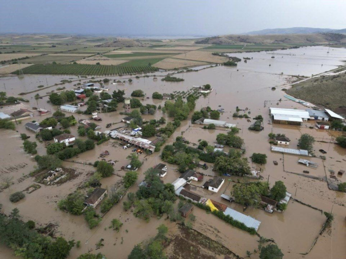
Around 24 hours with strong storms and southerlies up to 9 Beaufort

The temperatures, however, according to Mr. Arniakos, will not drop much, they will drop a bit due to the cloudiness, but due to the southerlies they will remain at 15-16 degrees Celsius, more reminiscent of October and November than February.
In particular, things change from tonight, as bad weather is coming from the west and mainly from the northern Ionian and Epirus, with rains and storms that will gradually spread over almost the entire country tomorrow Sunday, after today's 20s which we had in Crete, Central Greece and Peloponnese.
Where the phenomena will be intense
"The most difficult day will be Monday, where the rains and storms will be universal, while the strongest effects will be in the west, the Ionian, Epirus, Aetoloakarnania, Achaia, Ilia, Messinia, Thrace, the islands of the northern and eastern Aegean but also the Dodecanese, emphasizes the meteorologist.
In the rest of the regions we will have rain and temporary storms, including in Attica, which is determined from Sunday night until shortly before noon on Monday.
"The phenomena in Attica will be temporary, they will not last more than two or three hours and slowly the weather will improve from noon on Monday", he adds.
Very strong southerlies up to 9 Beaufort - Ships tied up in ports
A key element will also be the very strong south winds, notes Mr. Arniakos, which will reach 7 to 8 Beaufort, even 9 Beaufort is not excluded, pinning the ships in the ports.
In addition, a few snows will fall at high altitudes, due to the south winds, in the mountains of Epirus and Western Macedonia, and then also in the mountains of Central Greece, without, however, substantial difficulty, neither in the movements nor in the temperatures, concludes the meteorologist in CNN Greece.
Meteo's forecast
Hail, African dust, gusty winds and heavy rain are expected to be the main weather features from tomorrow, Sunday (11/02), according to Meteo.
The "express" bad weather will start with rain in areas of Western and Northern Greece. In the afternoon, the phenomena in the northwest will intensify and locally strong storms will occur, while until the evening the weather will show a similar deterioration in the Ionian Islands, the western mainland, Eastern Macedonia, Thrace and parts of the Peloponnese.
From late evening, the Central and Eastern Continent will be affected, including Attica and Evia.
On Monday 12/2 the strong phenomena which will initially affect several areas, will progressively be located mainly in the north-eastern country (with high levels of rain), in the islands of the Eastern Aegean and in parts of the Cyclades and from the evening in the Dodecanese. Also, rains and storms will continue until the afternoon in places in Western Greece. Southeasterly winds of 7-8 Beaufort will blow in the Aegean, but after noon they will show a progressive weakening and turn to the southwest. African dust concentrations will remain elevated. The EMY Emergency Bulletin The EMY issued an emergency bulletin, stating that heavy rains and storms are going to follow the spring landscape from noon on Sunday. In particular, a worsening of the weather with heavy rains and storms is predicted in most parts of the country from the early afternoon of Sunday (11/2) until the evening of Monday (12/02). The intense phenomena that will start from the northwest will gradually extend to the rest of the west, the northeast mainland, the islands of the eastern Aegean and the Dodecanese, while parts of the central country will also be temporarily affected. The winds in the seas will be strong and will reach 7 to 8 and locally in the Aegean 9 Beaufort. In detail, heavy rains are expected on Sunday: From midday hours in the northern Ionian and Epirus. From the afternoon hours in the southern Ionian, western Sterea, eastern Macedonia and Thrace. From the evening hours in the western and possibly the southern Peloponnese. On Monday are expected: In places in the early hours of the morning in Ionia, Epirus, western Sterea and western Peloponnese, with a rapid weakening of the phenomena from the north. From the early hours of the morning in the eastern parts of central Macedonia, eastern Macedonia and Thrace, with a gradual weakening of the phenomena from noon. Partly cloudy in the early morning hours in eastern Peloponnese, eastern Sterea (including Attica) and southern Evia. In the morning hours, it is possible that the northern Cyclades will also be temporarily affected. From the morning hours on the islands of the eastern Aegean. The intense effects from the afternoon will be limited to the southernmost parts and will gradually weaken. From the afternoon in the Dodecanese. During the night to Tuesday the strong effects will be limited to the area of Kastellorizos and will gradually weaken. Stormy southerlies will blow from the early hours of Sunday (11-02-24): In the Aegean with intensity 7 to 8 and temporarily up to 9 Beaufort. From midday on Monday, the stormy winds will be limited to the Dodecanese region and will gradually weaken. In the Ionian Sea with an intensity of 7 to 8 Beaufort and gradual weakening from the midday hours of Sunday.