Rain and storms expected on Wednesday in the west, south & east

The reason for the change in weather is the southeastward movement of a disturbance in the mid-troposphere from northwestern Europe to the Mediterranean region and the development of a surface low in the central Mediterranean region.
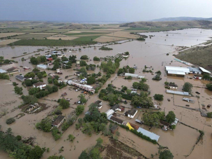
In more detail, tomorrow rains and local storms are expected from the early hours of the morning in the Ionian, Epirus, western Sterea, southern Peloponnese, Attica, Evia, Cyclades, southern Crete, the Dodecanese, the eastern and northern islands Aegean and Thrace. Also, possibly heavy rains and storms in the Dodecanese, the islands of the eastern and northeastern Aegean and the northern Ionian, where they are likely to be accompanied by significant amounts of rain. There is a slight chance of small hail in parts of the Ionian and Aegean. South-southeast winds will blow in the seas with intensities of 5-6 Beaufort and locally in the eastern and southeastern Aegean up to 7 Beaufort.
Finally, there will be a significant increase in minimum temperatures of 5-7 degrees, due to the prevalence of southerly winds and the transport of warmer gas masses.
The rains and storms towards the morning hours of Thursday are likely to intensify temporarily in parts of Thrace.
According to the Precipitation Episode Classification (RPI), which is implemented by the Meteo Unit of the National Observatory of Athens, the precipitation episode for tomorrow is classified as Category 3 (Significant).